Five Chinatowns, one continuing memory project.
Use the map as a learning diagram, then select each place to understand movement, rebuilding, and preservation.
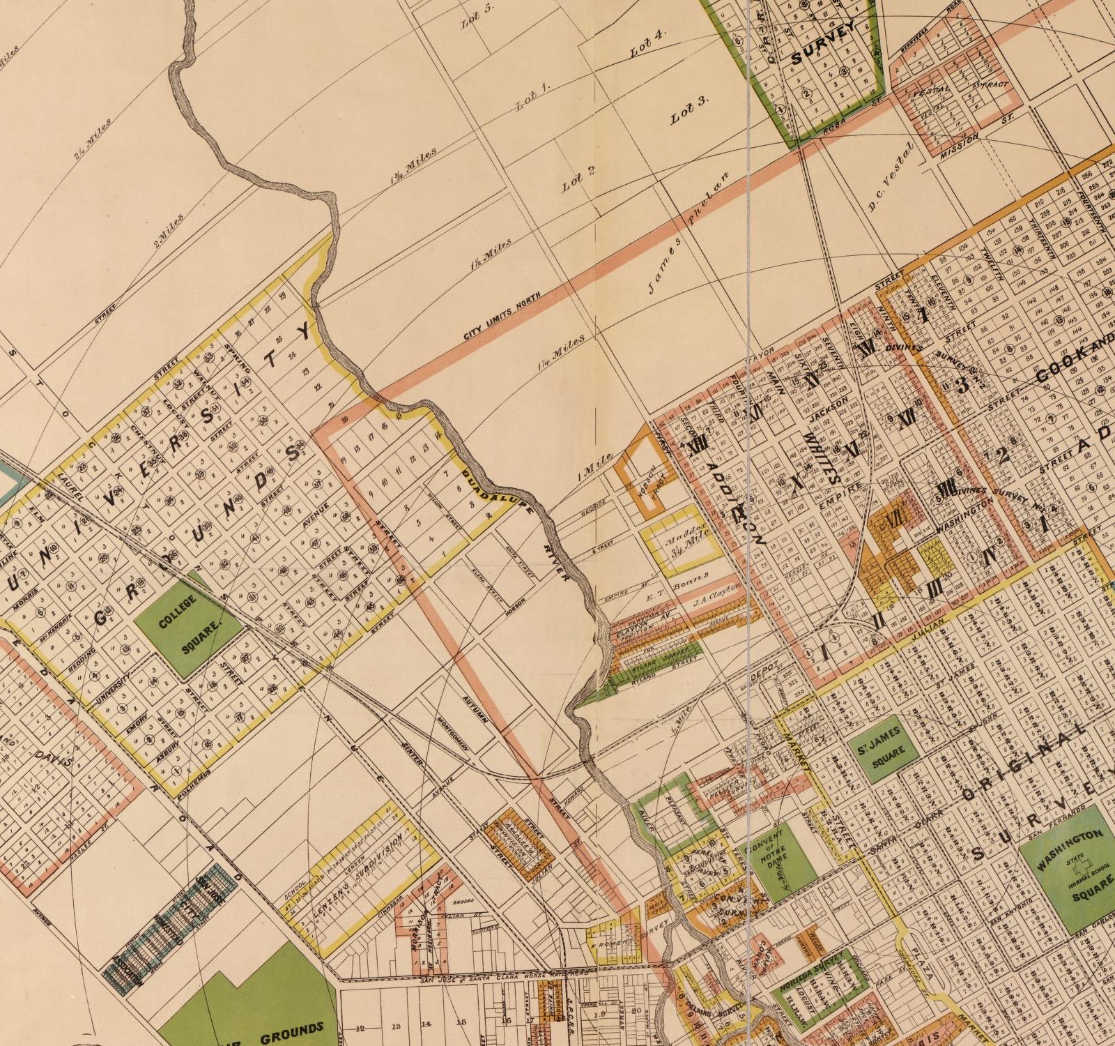
City Map
1886 historical base map
Approximate location diagram
Map Sources
The 1886 Clayton city map gives this page a stronger base layer because it shows roads, drainage, blocks, lots, tract names, and land ownership context across downtown San Jose.
The Library of Congress record identifies the 1884 Sanborn Fire Insurance Map for San Jose as a 72-sheet public-domain map set.
The 1891 Sanborn volumes add post-fire context for San Jose and Santa Clara, but they remain best as sheet-level detail references rather than a single citywide base map.
The Library of Congress guide explains that Sanborn maps show building footprints, construction details, street names, property boundaries, and building use.
USGS historical topographic maps can supplement the story at regional scale, but they are less useful than city and Sanborn maps for block-level Chinatown locations.
Second Market Street
Market and San Fernando
Largest of San Jose's five Chinatowns; burned May 4, 1887.
Memory Lineage
CHCP was founded in 1987 by Lillian Gong-Guy and Gerrye Wong to preserve Chinese American and Chinese history and culture in Santa Clara County.
CHCP's first major project was reconstructing Ng Shing Gung, originally built in Heinlenville in 1888.
Jessica Yu's Home Base documentary follows Heinlenville from the 1887 arson aftermath to the late-1980s effort to reconstruct the temple.
The Market Street Chinatown Archaeology Project turned an inaccessible, orphaned collection into material for research and education.